Utility Locating · Outdoor & Site Work

MAP THE SITE
BEFORE THE
FIRST DIG.

Before you trench, grade, or excavate — we locate and map every utility in the work area. Gas, electric, water, sewer, telecom, storm. APWA color-coded, georeferenced, delivered same day.

6+
Utility Types Mapped
Same
Day Deliverable
KML
+ PDF + HTML + PNG
Our Commitment

NO UPSELL
AGENDA.

No app to download. No sales team trying to upsell unnecessary service lines. No monthly subscriptions for platforms to see the work you already paid for. With Ground Radar Techs — you pay for the scan, you own the deliverable, and your findings belong to you the moment the job is complete, and they stay yours without a password or a payment plan attached.

What We Locate

EVERY UTILITY. APWA COLOR-CODED.

We locate and map all standard subsurface utilities using GPR and EM, following APWA color conventions so the entire project team reads the deliverable the same way.

GAS

YELLOW

ELECTRIC

RED

WATER

BLUE

SEWER

GREEN

TELECOM

ORANGE

STORM

PURPLE

Why Private Utility Locating Matters

811 DOESN'T MARK EVERYTHING.

Calling 811 is required — but it only marks public utilities. Private gas lines, electrical, water, telecom and sewer lines inside your site boundary are invisible to 811. That's exactly what we find.

WHAT 811 COVERS

Public utility lines only

  • Public electric lines
    On public right-of-way only
  • 💧
    Municipal water mains
    Street-level mains, not private laterals
  • 🔥
    Public gas mains
    Distribution lines, not private service
  • Private lines not marked
    Anything past the meter or property line is off-limits to 811

WHAT Ground Radar Techs LOCATES

Everything 811 misses

  • 🔦
    Private gas service lines
    From meter to building, laterals, distribution
  • 🔌
    Private electrical conduits
    Buried feeders, branch circuits, lighting
  • 📡
    Telecom & data lines
    Fiber, copper, coax — all depths
  • 🌊
    Water & sewer laterals
    Private service connections, storm drains
The Rule of Thumb

If a utility runs from the public main to your building — or anywhere inside your property boundary — 811 won't mark it. We will.

Real Projects

WHAT WE FOUND.

Every job tells a story. These are real Ground Radar Techs projects — what the contractor needed, what we found, and what getting hit would have cost.

Mechanical Contractor — West End, Nashville

Pre-Excavation Trench Scan — 1,200ft Corridor

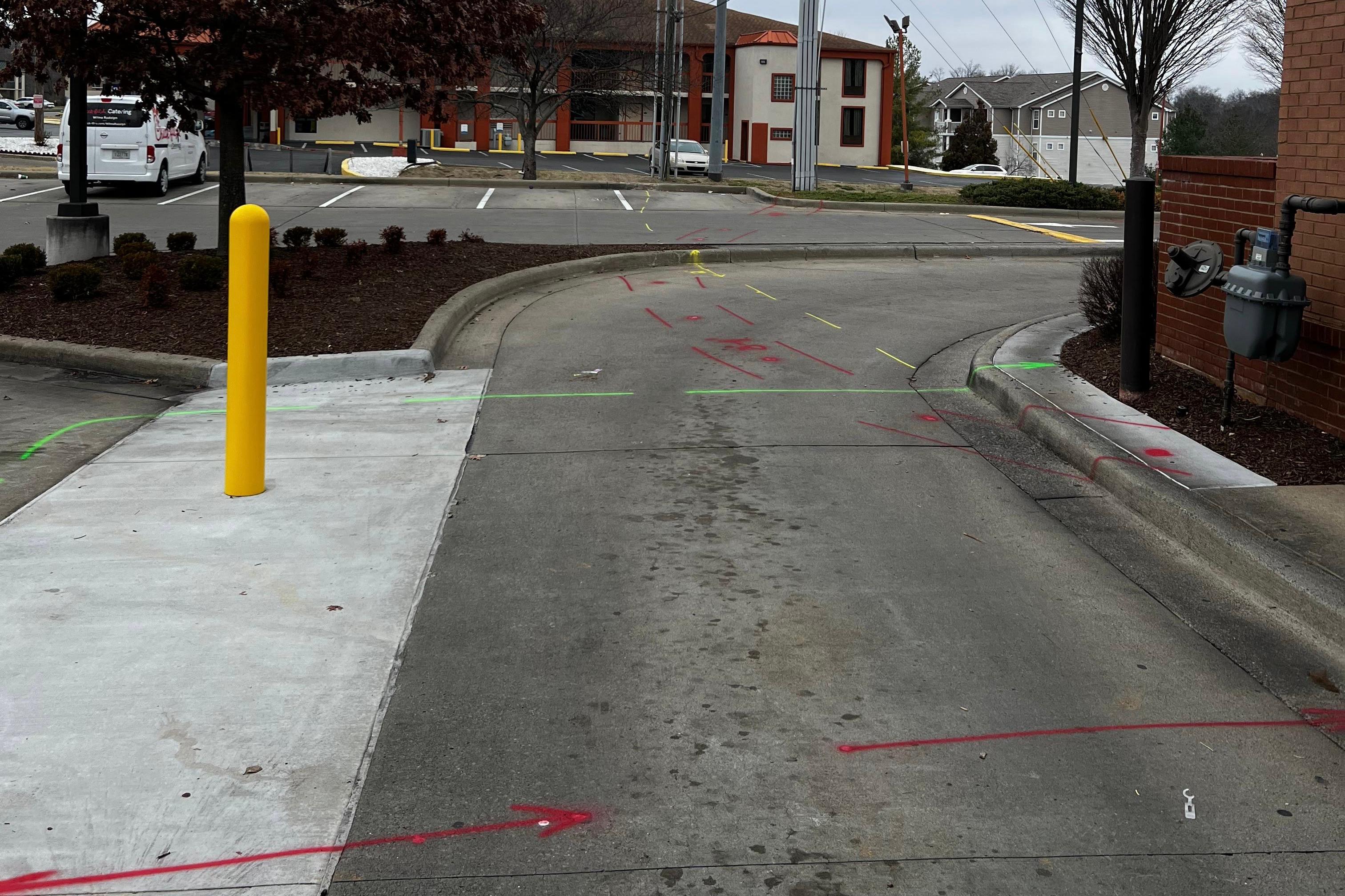
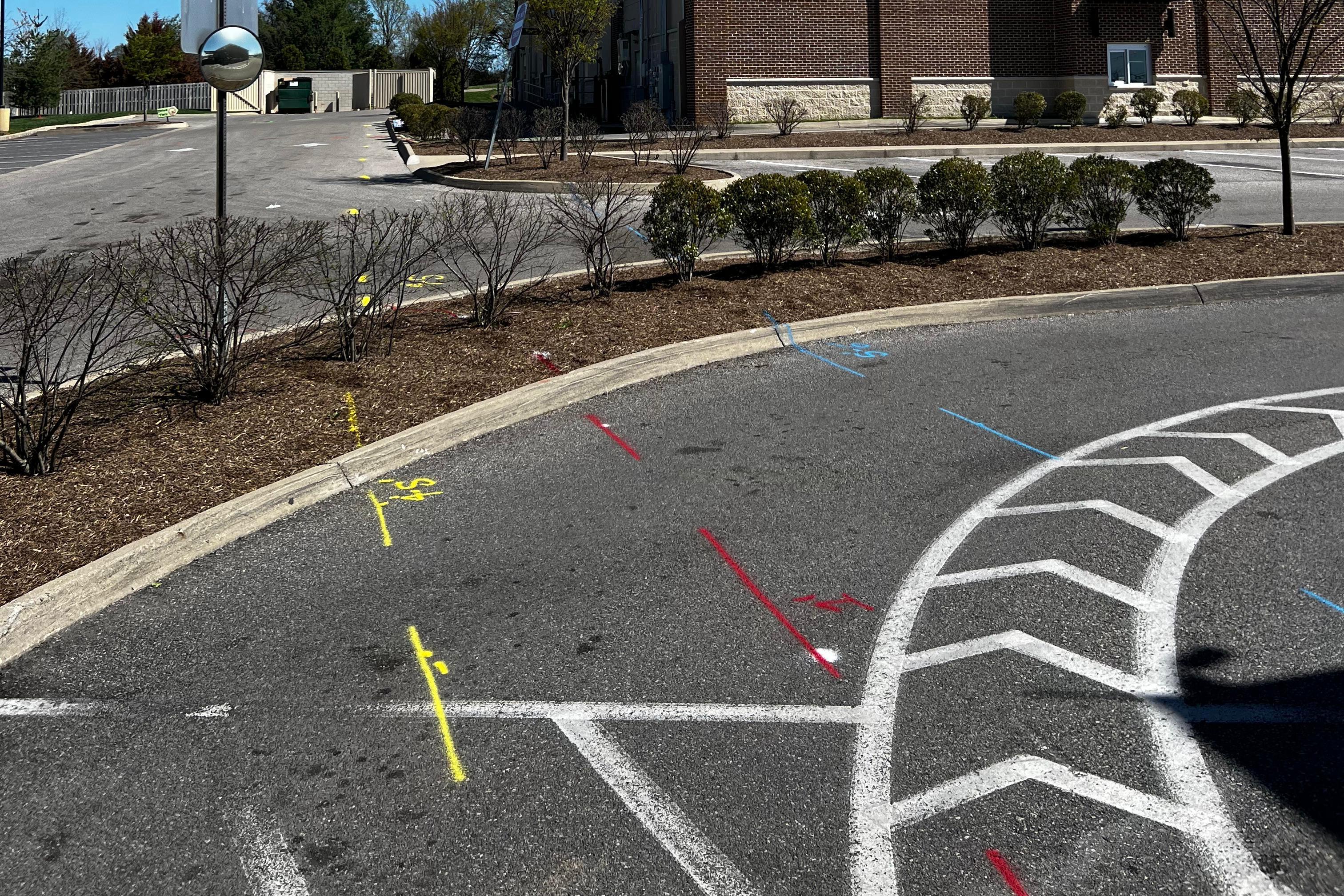
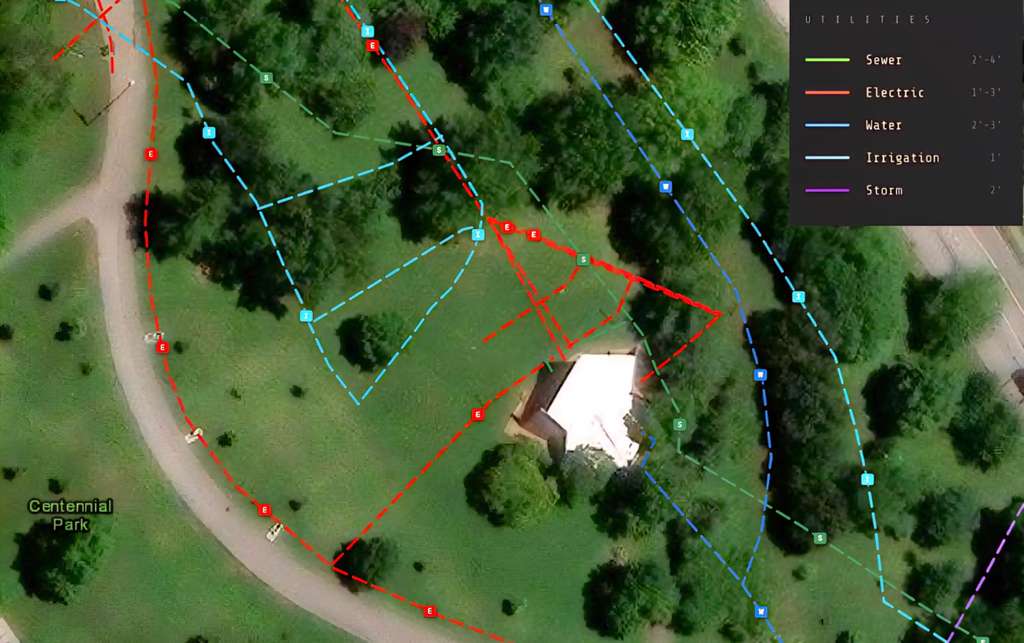
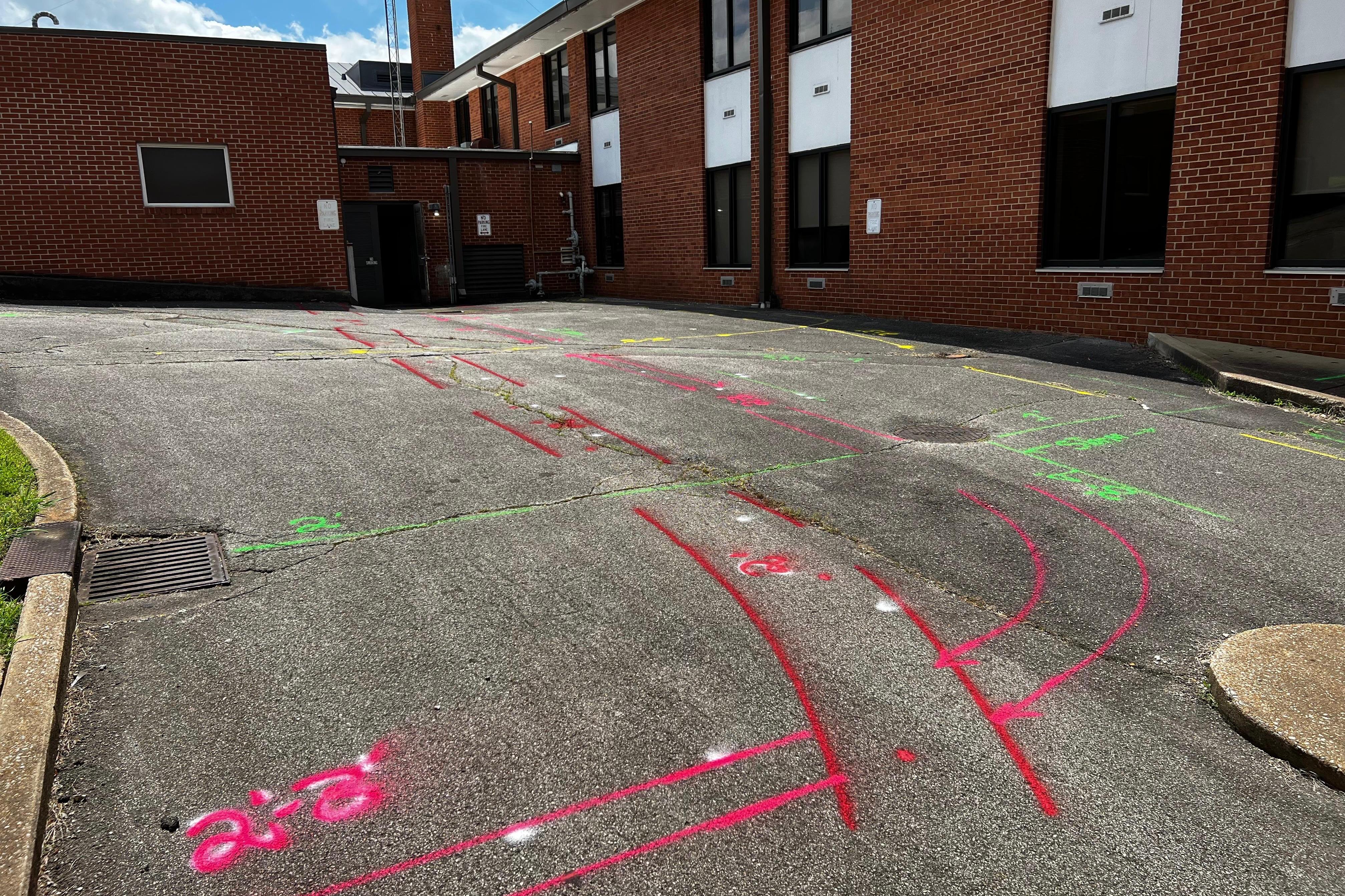
Mechanical contractor needed a 1,200ft × 15ft trench corridor scanned before excavation. Located electric, telecom, and unknown utilities at varying depths — all marked APWA on-site and mapped in the deliverable before the first shovel.

Utilities Found
Electric · Telecom · Unknown
Avoided Strike Cost
$25K+
Plumbing Contractor — West End, Nashville

Private Lateral Locate Before Water Service Tap-In

Plumbing crew needed to tap into a water service inside the property boundary — but 811 stopped at the public main. Ground Radar Techs mapped private water, sewer, and gas laterals from the right-of-way all the way to the building wall. Safe penetration, no surprises.

Utilities Found
Water · Sewer · Gas Lateral
Avoided Strike Cost
$10K–25K
Concrete Cutting Partner — North Nashville

Site-Wide Pre-Demolition Utility Map

A concrete cutting partner needed a full pre-demolition utility picture before mobilizing crews. Ground Radar Techs mapped electric, water, sewer, gas, and telecom across the entire site — delivered as KML and PDF so the demo plan could be built around live service lines, not in spite of them.

Utilities Found
5 Types · Site-Wide
Deliverable
KML · PDF · HTML

UTILITIES, MAPPED.
SITE-WIDE. IN COLOR.

When the job demands more than surface chalk, we produce site-wide utility maps — georeferenced, APWA color-coded, and delivered with depth data the whole team can read. Here's a recent site at Centennial Park, Nashville.

Ground Radar Techs · UTILITY MAPPING DELIVERABLE
Site CENTENNIAL PARK City NASHVILLE, TN Method GPR + EM LOCATE
Ground Radar Techs utility mapping deliverable at Centennial Park, Nashville — color-coded trace of sewer, electric, water, irrigation, and storm utilities overlaid on aerial imagery
01 · CAPTURE
Field-grade GPS + GPR traces
Every line located is logged with coordinates, depth, and utility type — not just sprayed on grass.
02 · MAP
Site-wide deliverable with legend
APWA color-coded overlays on aerial imagery. Shareable as KML, PDF, interactive HTML, or PNG.
03 · DEFEND
Documentation that holds up
Filed with the owner, shared with the design team, referenced by the excavator. One record, one source of truth.
The Deliverable

REPORTS BUILT TO
TRAVEL UP THE CHAIN.

A utility map is only as useful as the number of people who can read it. Ground Radar Techs deliverables move from field crew to civil engineer to owner without anyone reformatting.

Most utility locates end at paint on the ground — and three rain showers later, the information is gone. That's not documentation.

Ground Radar Techs utility maps are delivered as KML, PDF, interactive HTML, and PNG — the same data, four formats, every time. Load it in Google Earth, attach it to an RFI, file it in the owner's close-out binder. It's durable, shareable, and defensible.

PAINT ON GRASS WASHES AWAY.
A Ground Radar Techs MAP DOESN'T.
01
Civil Engineers
Load the KML, overlay on site plans.
Overlays It
02
Excavators
Know every line before the bucket drops.
Reads It
03
Project Managers
Forward to subs, attach to change orders.
Shares It
04
Owners
Into the as-built record, permanent.
Files It
05
Inspectors
Georeferenced proof of pre-dig locate.
Accepts It
The Positioning Shift

WE DON'T JUST HAVE
GREAT EQUIPMENT.
WE PROTECT YOUR PROJECT.

Ground Radar Techs is positioned around outcomes for the contractor's business — not specs on a scanner.

01
Protected
Schedule
Same-day maps keep the dig crew moving. No stoppages waiting on locates.
02
Defensible
Documentation
Georeferenced, photo-backed, and permanent. Protection if a strike is ever investigated.
03
Zero Coordination
Overhead
We handle the locate, produce the deliverable, and hand off to the next trade.
04
No Conflict
Of Interest
We don't excavate, we don't trench, we don't upsell. Only incentive is accurate findings.
05
A Partner For
The Next Step
Need hydro-vac or pothole confirmation? We coordinate the vendor handoff.

READY TO MAP
YOUR SITE?

Before you trench, grade, or excavate — one call gets the locate, the map, and the documentation your owner will file.

Call 615-989-0111